http://prezi.com/cqtnaab0xkzi/?utm_campaign=share&utm_medium=copy
Showing posts with label GEOGRAPHY NOTES. Show all posts
Showing posts with label GEOGRAPHY NOTES. Show all posts
Sunday, 2 April 2017

Monday, 27 March 2017
SELF-ASSESSMENT
- What can I do that I couldn't do before?
- What did I like most?
- What did I do well?
- What am I confused about?
- What did I do in English outside the class?
- What do I need to improve?
- What did I learn about culture?
Hi everyone!
We are finishing the second terms and now I am veeery nervous because there are a lot of exams to do yet.
But anyway,that's my business! This is one expression that I have learned this term I have also learned more things like the past perfect tense or a lot of weird vocabulary that I didn't know, I learned the different misunderstandings that you can have when you travel abroad,I learned what does it mean ''gap'' hhaha it's very important this word for me because it is the typical word that you learn and you will never forget haha.I learned the different types of agricultural landscapes in Geography,this part of the term was the most boring because I don't know it's something that you must know and it was a little bit boring but a good point of that unit was learn the names of different types of fish,animals or crops,as well as in English that we have learned the types of crimes and criminals; but the best part of this term in Geography was the unit which was about forms of government,laws and the political system in Spain,because I love talking about these things...I don't know haha I think that are really interesting. In Physical Educatiton we have learned how to do acrosport and how to play badminton,I really love playing badminton!
In English and Geography we read a book about Marco Polo's and Roald Amundsen's journeys,it was interesenting know about the lifestyle of those years; we also did a project about a country,I chose New Zealand and I learn a lot of this country,for example that is part of an association called ''Commonwealth'' or the main sports there like rugby. I think that it will be really funny and enjoyable if we do for the nest term a videoclip in which we show the best parts of the other terms and pictures about us.It will be great...but it's just a suggestion!
I think that I do a good job this term and that I did my best effort, but I can improve more in different skills like vocabulary.But they were a good and funny months hahaha because Cristina's and Teresa's classes are pretty funny and enjoyable because we learn things but without the same techniques like 'open the book page 37 and copy that vocabulary' and the way they teach it's great and we learn new things everyday.
Hope the next term will be better than this was!
Wednesday, 15 March 2017
AGRICULTURAL LANDSCAPE. GEOGRAPHY
AGRICULTURAL LANDSCAPE

This picture is a landscape from Zaragoza, Aragón, Spain. It lies on the south bank of the Ebro River
You can see clearly that is an agricultural landscape because as the definition that Teresa gave us,it's land that has over time been transformed by human beings and by farming activities ir order to obtain products from nature.
Let's talk about the different characteristics of its physical factors; Zaragoza it's formed by valleys, mountain ranges and cliffs because of the Prepyrenees (Moncayo). Its climate is a Continental one,that is characterised of regular precipitations and high temperatures throughout the year as you can see bellow:

Now we are going to talk about the plots,as you know the plots can vary in size, in this case some are quite big because you can't see the end of them. They are enclosed fields because are irregular plots separated by fences and roads of that village.
The farming system that is used here, is monoculture system, in which each farmer grow a single crop in his plot/s. Here in Zaragoza the main crops to grow are: cereals like corn and fruit trees like orange,tangerine,peach,lemon and apple trees.
All of these crops are crops that grow by the method of irrigation in which a controlled amount of water is supplied to plants at regular intervals for agriculture; using irrigation sprinklers. It is also intensive agriculture that happens in densely populated areas and in which farmers use fertilisers and machinery, the aim of this type of agriculture is to make the productivity higher.
Tuesday, 14 March 2017
SECOND TERM PROJECT. NEW ZEALAND
Here it is the link of our project of New Zealand. Hope you like it!
Made by: Álvaro Calvo, Irene Gómez and Gadea Rodríguez


Saturday, 14 January 2017
AFRICA VIDEO.GEOGRAPHY
ANSWER THE
FOLLOWING QUESTIONS
1.
Where in the world is Africa ?
2.
How many times is Africa
larger than The United States?
3.
How is the savanna defined in the video?
4.
Which animals can be found in the savanna
biome?
5.
Where is located the chaparral biome in Africa ?
6.
Which are the most famous deserts in Africa ?
7.
The main natural resources mentioned in
the video are ....
1. Africa is located
at the South of Europe and at the Southwest of Asia.
2. Africa is three
times the size of The United States.
3. The savanna biome is defined in the video as a
grassy plain which covers nearly half of Africa.It's characterized by scattered
trees among a landscape of grasses and shrubs.
4. The most common animals that can be found in the
savanna biome are elephants and giraffes.
5. The chaparral biome is located at northern coast of
Africa and along the Mediterranean coast and there is also in the south of Africa as well.
6. The most famous deserts in Africa are the Sahara
desert, the Namib desert and the Kalahari desert .
7. The main natural resources mentioned in the video
are gold mines,rober trees and oil.
FIND THE MISSING WORDS
1. Africa runs 5 000 miles from the
Mediterranean sea all the way down to the
Cape of Good Hope and 4 600 miles from Cape Verde all the way over to Senegal
2. Biomes are climate zones and throughout that
area, throughout that climate
zones , you can see the same average temperature and average precipitation what that means is
that you also see very similar fauna
and vegetation living in that region.
3. The most famous desert in Africa is, of course,
the Sahara desert. Now, some parts of the Sahara desert are sandy, like you can see here. Other parts of the Sahara
desert are rocky but in either
case, the fact that it is very dry is going to make
it a very difficult barrier to cross.
4. It is not the rain itself that’s
particularly important, it’s also the biodiversity There are many different fauna and
vegetation That can be found in the rain forest and that’s one of
the thing that makes the rain forest so valuable not just in Africa
but throughout the Earth.
5. The Nile is the most famous river in Africa ,
because is the largest river in the
world. But there is also the Congo river which is the naive longest river
in the world.
6. Africa actually has its own version of the Great
Lakes with
famous lakes like lake
Malawi,lake Victoria and lake Tanganyika.
7. All the Africa
is a plateau. Meaning that Africa itself is an
elevated land.
But that doesn’t mean that you can’t find any mountain ranges like, for
example, the Atlas mountains in northwestern Africa .
8. Africa also has some interesting mountains like
Kilimanjaro mountain , the highest mountain in Africa which seems to
just rise
on it own out of the ground
9. The Great Rift Valley refers to a region ofAfrica
that is literally, being split apart. There are some tectonic
plates that are located within or near Africa,
that are, actually moving away from each other, and what’s doing is creating not
just some of the highest elevations in Africa, but also lakes like Tanganyika
9. The Great Rift Valley refers to a region of
Wednesday, 7 December 2016
GEOGRAPHY UNIT 3. POPULATION


Dependent population. The population that don't work and that are dependent of the other ones that work.
Ageing population. The population of Spain in 2050
Friday, 4 November 2016
VALLADOLID AND PEÑAFIEL TRIP
On Wednesday 4th of November,we went with Teresa,Gema and Luis and ,of course,all of our classmates and friends,to Valladolid.
We arrived there at 10:00 in the morning and we went to see the centre of this big city,we bought the lunch and some souvenirs to remember that day.Then we went at 11:00 to the Miguel Delibes Theatre to see a concert of Contemporany music,that in my opinion it was a little bit weird because the music and works were explained like a tail and I have never see that haha but I like it a lot.
When the concert finished we had lunch at a skatepark (that I liked a lot haha) near a Carrefour,where we went after having lunch.
At 15:00 in the afternoon we took a bus to Peñafiel,where we visited the Castle with the shape as a ship and with a lot of stairs to go to the top of it haha.Then we visited the Museum of Wine too,this was a little bit boring,because they didn't explained nothing to us about the process of making wine,but it was okay too.
Then at 18:30 we took the bus to come back to Villamayor.
The things that I liked more are,the trips in the bus,because you have fun with your friends and classmates singing and dancing and laughing too haha.I liked a lot Valladolid because I took a lot of pictures there and I like and know a lot of this city.I also liked the Castle and the very good pictures and memories of that visit.
I hope that we do more trips of this type because you learn a lot and you also have fun.


We arrived there at 10:00 in the morning and we went to see the centre of this big city,we bought the lunch and some souvenirs to remember that day.Then we went at 11:00 to the Miguel Delibes Theatre to see a concert of Contemporany music,that in my opinion it was a little bit weird because the music and works were explained like a tail and I have never see that haha but I like it a lot.
When the concert finished we had lunch at a skatepark (that I liked a lot haha) near a Carrefour,where we went after having lunch.
At 15:00 in the afternoon we took a bus to Peñafiel,where we visited the Castle with the shape as a ship and with a lot of stairs to go to the top of it haha.Then we visited the Museum of Wine too,this was a little bit boring,because they didn't explained nothing to us about the process of making wine,but it was okay too.
Then at 18:30 we took the bus to come back to Villamayor.
The things that I liked more are,the trips in the bus,because you have fun with your friends and classmates singing and dancing and laughing too haha.I liked a lot Valladolid because I took a lot of pictures there and I like and know a lot of this city.I also liked the Castle and the very good pictures and memories of that visit.
I hope that we do more trips of this type because you learn a lot and you also have fun.


GEOGRAPHY. DESCRIBE A LANDSCAPE
IGUAZU FALLS
For this project I have choose IGUAZU FALLS in Argentina

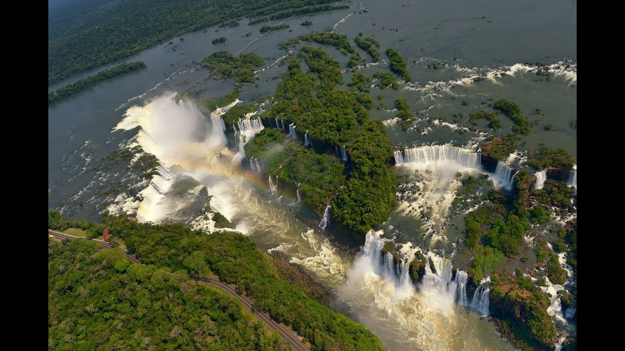

-SUMMER. (From December to March) the temperatures are high and regular during the whole 24 hours due to its regular and abundant precipitations that cause that the climate be very wet.
-AUTUMN. (From March to June) the temperatures during the day are mild and sometimes high but during the night they are cold.
-WINTER. (From June to September) the temperatures are mild during the morning and in the first hours of the afternoon,then the rest of the day they are cool but at the night they fall sharply.
In all of these seasons the precipitations are very abundant,but there is a lot of humidity.
-SPRING. (From September to December) The temperatures are high during all the day and the nights are cool but plesants.This is the best season to visit this falls becauese the precipitations aren't very abundant and the temperatures aren't very hot like as in summer.
The vegation of Iguazu Falls
The ''Selva Misionera'' houses more than 2000 species of plants and flowers,the abundant precipitations and the hot of the Subtropical sun make it,one of the regions of the planet with the most biodiversity.

One of the most common specie of this park in ''Palo Rosa'' a tree that measure more than 40 meters,its name is due to the colour of its wood,and it is a ''Monumento Nacional''.And this type of tree habit with a specie of a palm tree called ''Palmito'' (the cut of this tree causes the death of it)


Another tipical plants of this climate are the ''helechos arborescentes,the orquídeas,the guatambú,the pindó and the clavel of the air''.And the ''Ceibo''.


The fauna of the Iguazu Falls
-SPRING. (From September to December) The temperatures are high during all the day and the nights are cool but plesants.This is the best season to visit this falls becauese the precipitations aren't very abundant and the temperatures aren't very hot like as in summer.
The vegation of Iguazu Falls
The ''Selva Misionera'' houses more than 2000 species of plants and flowers,the abundant precipitations and the hot of the Subtropical sun make it,one of the regions of the planet with the most biodiversity.

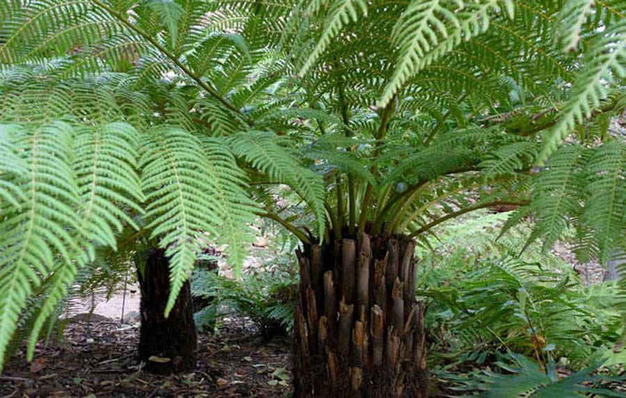

The fauna of the Iguazu Falls
Is formed of mamals, the mono capuchino,the oso melenero,the comadrejas and the coendú.


Sunday, 16 October 2016
GEOGRAPHY UNIT.2 THE NATURAL ENVIROMENT
CLIMATE AND BIOGEOGRAPHY IN EUROPE
Beeches. Any of various deciduous trees of the genus Fagus having smooth gray bark, alternatesimple leaves, and three-sided nuts enclosed in prickly burs.
- MARITIME. Found on the western edge, with mild temperatures and little variation.It has a region of abundant precipitations.
- MEDITERRANEAN. Found throughout.It has higher temperatures as well as lower and more irregular precipitations.
- CONTINENTAL. Lower temperatures and huge temperature contrasts because of its distance from the sea,with very dry summers.
- ALPINE. The altitude causes a decrease in temperatures and an increase in precipitation.This type of climate is found in all the mountain ranges.
- POLAR. Located beyond the Artic Circle,this climate type has little precipitation (snow) and very low temperatures.
MARITIME.

Shrubs/ thickets


Here there're also deer,foxes,salmon,seals and water birds.
MEDITERRANEAN.
Meadows.

Cork.

Boar.

Fallow.

Stork.

Vulture.

CONTINENTAL.
Taiga.The zone of forest vegetation lying on wet soils between the tundra in the north
and steppe hardwood.
Forest in the south.

Firs.

Steepe.Is an ecoregion,in the montane grasslands and shrublands and temperate grasslands, savannas, and shrublands biomes, characterized by grassland plainswithout trees apart from those near
rivers and lakes
Steppes are usually characterized by a semi-arid and continental climate.

Here there're also brown bear,wolf,marten,mink,deer and raptors.


ALPINE.
Alpine pastures.

Here there're also deer,wolf,bear,chamois,marmot and eagles.


POLAR.
Tundra. Is a biome where the tree growth ishindered by low temperatures and
short growing seasons.

Here there're also reindeer, seal and whale.


CLIMATE AND BIOGEOGRAPHY IN SPAIN
Spain has an oceanic or Mediterranean climate on the peninsula,an Alpine climate in the higher regions and a Subtropical or Canarian climate in the Canary Islands.
- THE CANTABRIAN COAST AND GALICIA. Has a maritime climate consisting of cool winters and mild summers,with a little variation of temperatures and with rain throughout the year.
- THE MEDITERRANEAN COAST AND SHOUTHEAST ANDALUCÍA. Has the highest temperatures in Europe.Precipitation is low and irregular.
- THE INTERIOR OF THE PENINSULA. It is characterised by large contrasts in temperature (very hot summers and very cold winters).Precipitation is low and irregular.
- ALPINE CLIMATE. This has abundant precipitation and low temperatures,but it varies between the mountain ranges of the North and of the South.
- CANARIAN OR SUBTROPICAL CLIMATE. Is hot and dry, there are significant differences between the semi-desert eastern islands and the more humid western ones.
MARITIME.
Maritime forests.

Here there're also fox,brown bear,wildcat and capercaillie.


MEDITERRANEAN.
Clear forests (pine)

Meadows (holm oak and cork oak)


Bush.

Pine.

Here there're also fox,rabbit.fallow deer,partridge and falcons.

)

ALPINE.
Alpine pastures.

Here there're also marmot,eagles and wolfs.
CANARIAN.
Dragon tree.
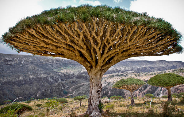
Laurel forest.
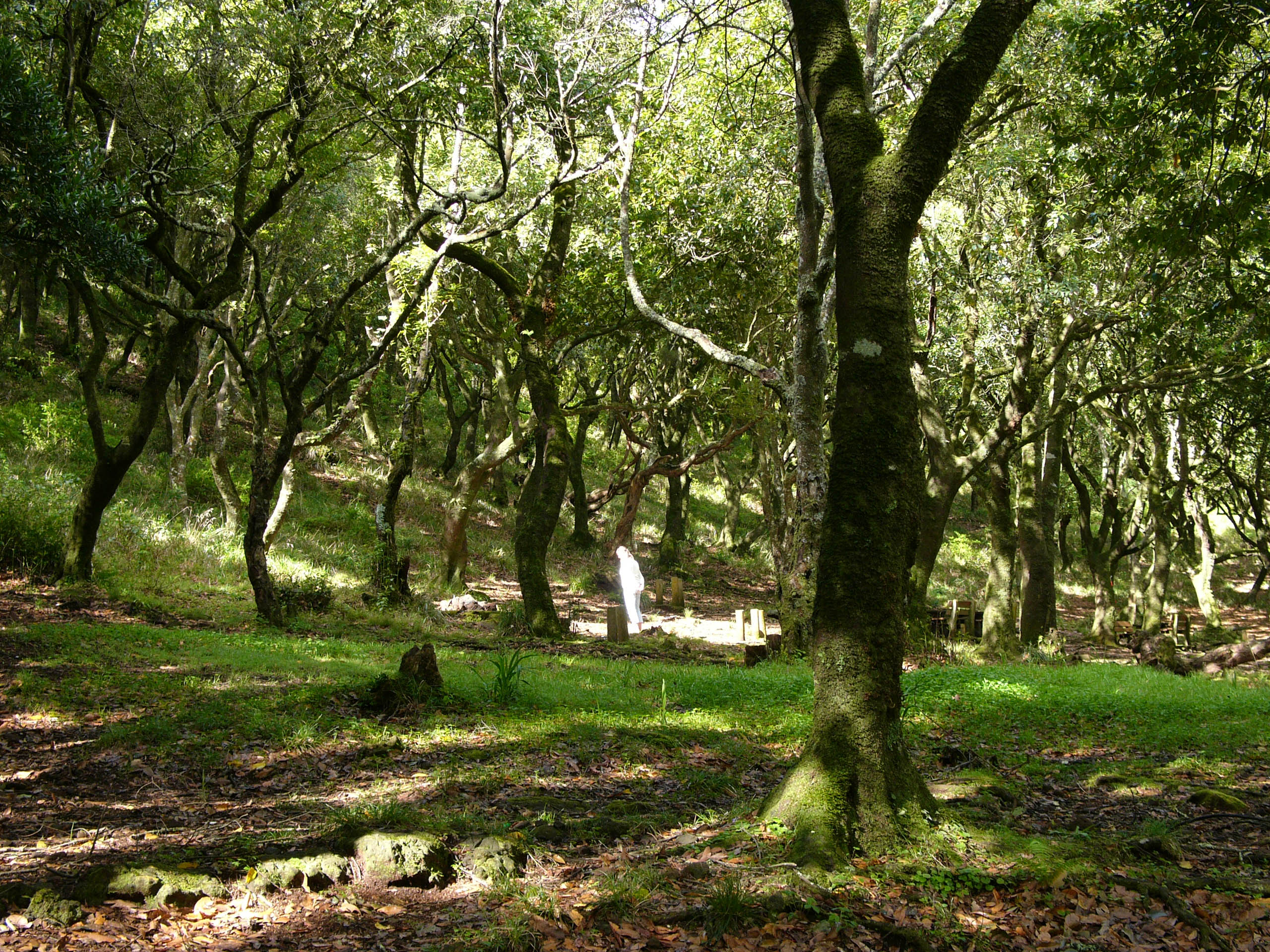
Here there're also Tizon lizard,dove, turkey and gulls.


Subscribe to:
Posts (Atom)